

 Share This Page
| Home | | Sailing | | Alaska 2009 | | | | Share This Page |
Copyright © 2009, P. Lutus. All rights reserved. Message Page
(double-click any word to see its definition)
Coghill River Hike
This wasn't a "hike" exactly — but let me explain. I often visit Coghill Point on College Fiord (in Prince William Sound) and hike a trail between the Coghill Point anchorage and a Forest Service cabin near Coghill Lake, a big lake in a wild place surrounded by glaciers. But the trail to the cabin is very rough, a lot of pointless ascending and descending, poorly maintained, and at one point you are obliged to cross a rickety wooden walkway across a sheer vertical drop.
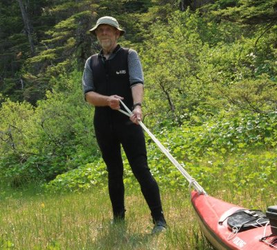
In years past, while hiking on the trail, I've looked over at Coghill River and wondered if it wouldn't be easier and more fun to take my kayak up the river instead of hiking that terrible trail. This season I decided to try the river, and it was easier — at least for me. (My kayak now needs repair, because of this and similar outings where I've dragged it across rough ground.)
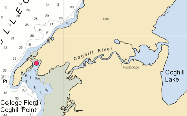
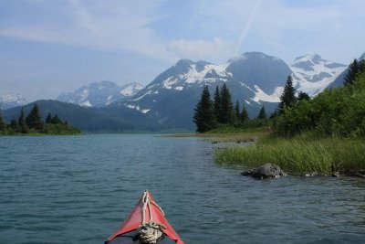
Because I would be passing through the river delta, with strong tidal and river currents, I chose a day when the wind wasn't too strong — it can be difficult, even dangerous, to navigate tidal shallows in a combination of strong current and strong wind. It turned out the most difficult part of this paddle was finding the actual river route in a very large river delta (the tan area at left of Figure 1) at low tide (it's easier at high tide when the delta is mostly submerged).
After dragging my poor kayak across several gravel bars, I found the actual river and began paddling upstream. The river current was better than four knots at times, which means it was easier to walk my boat through the shallows along shore. A combination of gravel-bar drags, shallow water pulls and paddles brought me to the footbridge shown in Figure 1.
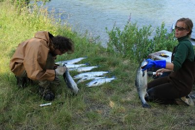
Getting past the floating footbridge required me to move out of the river and onto the bank, where I met some scientists studying locally caught salmon. The study is meant to answer an important question — how many salmon caught in the wild are native and how many escaped from commercial salmon farms? There are a number of difficult ways to make this determination, but one of the easy ways is to examine the salmon's inner ear bones (otoliths), which is what the researchers were doing.
Commercial salmon farms raise Atlantic salmon, and some of these salmon escape into the wild where they compete with native salmon. The problem is that Atlantic salmon are very aggressive and outcompete the native variety, but the Atlantic salmon don't go on to establish themselves as an ongoing, reproducing species in the wild. This creates an overall reduction in salmon numbers, and possible extinction of the native species in the long term.
After this educational visit, I paddled on toward the lake. I need to explain something — because I had only walked the footpath until this season, I had never actually seen Coghill Lake, just the little lake to the west of it where the trail ends and the cabin is located. Well, Coghill Lake is spectacular — it's about 4½ miles long and surrounded by glaciers and peaks. It was well worth the paddle.
The return trip along the river was extremely fast — to avoid obstacles in the river I wanted to maintain some directional control over the kayak, so I was paddling at perhaps two knots, the river's current was as much as four knots in places, this resulted in a wild ride that might only have taken 15 minutes.
By the time I returned to the river entrance, the tide had risen substantially and the entire confusing delta area was below the surface (which is why I know a high tide approach would be easier). I have to say the river route to Coghill Lake has it all over the trail.
For those who might visit Coghill Point in a boat, I have one more comment — the charted and real depths in the bay are mostly quite shallow, but at the head of the bay (the red dot in Figure 1) there is a deep hole, almost ten fathoms deep, not charted. It's perfect for anchoring a big boat like mine.
| Home | | Sailing | | Alaska 2009 | | | | Share This Page |